
Walkable
Safety-first walking navigation to walk the safest routes
About Walkable
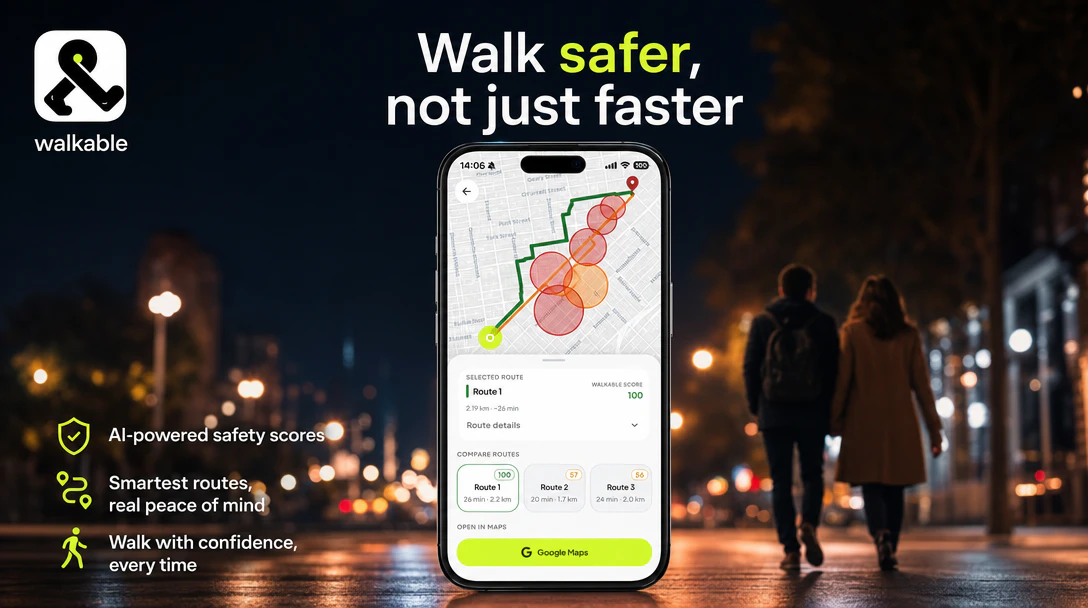
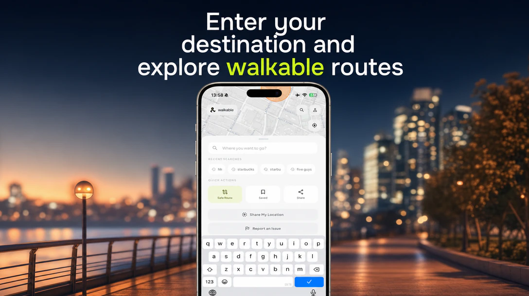
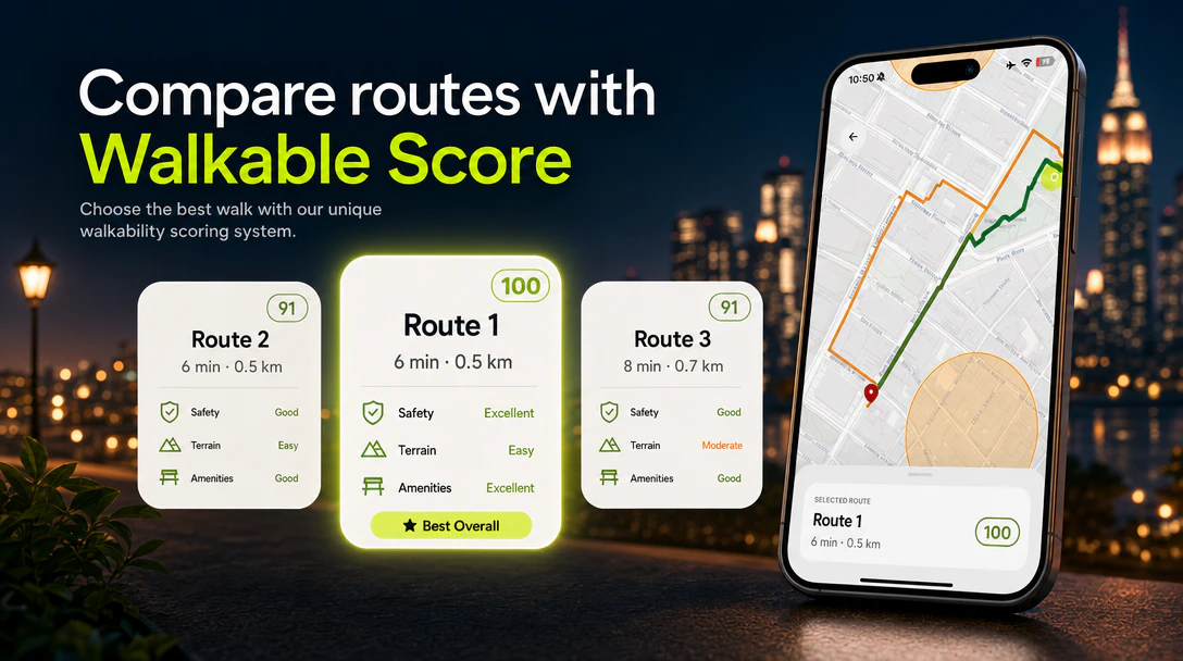
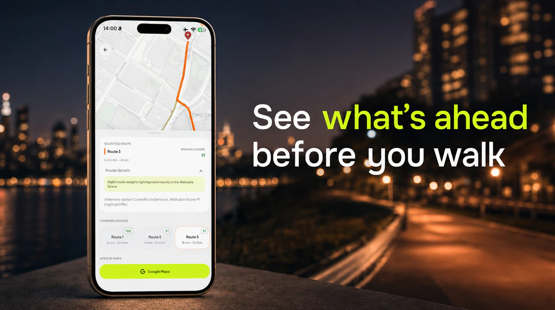
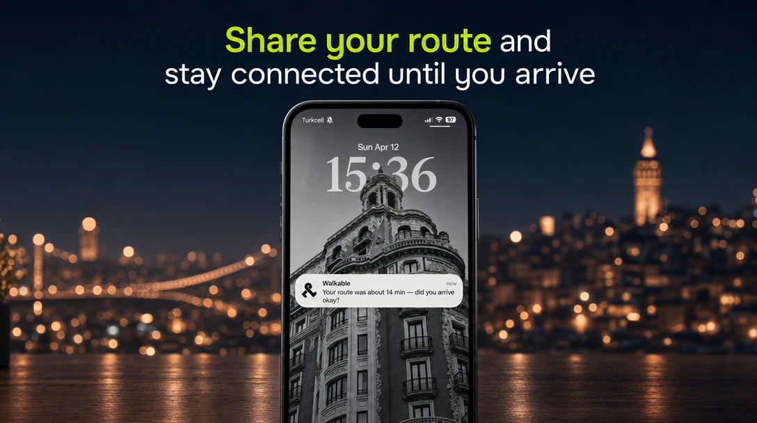
Walkable is a safety-focused walking navigation app designed for pedestrians who prioritize security and peace of mind. Unlike traditional maps that often route users through dark, poorly lit, or isolated areas to save a few minutes, Walkable emphasizes safety by providing real-time route recommendations based on a comprehensive Walkable Score. This score considers factors such as lighting, foot traffic, time of day, and live safety signals, including crime activity data. Users can select from Safest, Balanced, or Fastest routes, allowing them to walk confidently, especially in unfamiliar or potentially risky environments. The app is particularly tailored for women, parents, travelers, and anyone who refuses to compromise safety for convenience. Its innovative approach makes walking safer and more reassuring, transforming urban navigation into a secure experience.
Screenshots
Pros
- ✓Prioritizes user safety by integrating real-time crime and safety data into routing decisions
- ✓Offers customizable route options (Safest, Balanced, Fastest) for different user preferences
- ✓Designed specifically for vulnerable groups like women, travelers, and parents
- ✓Enhances confidence while walking in unfamiliar or high-risk areas
- ✓Utilizes live safety signals for the most current route recommendations
Cons
- ✗Limited user base and community data since it's a newer or niche app
- ✗Potential dependency on local crime and safety data accuracy
- ✗May not be available in all geographic regions
Use Cases
Pricing
Likely offered on a freemium model, providing basic safety routing features for free with optional premium plans for advanced features or detailed safety insights. Specific pricing details are not publicly confirmed.
Quick Info
Topics
Makers
Ekim Cem Ülger
Alternatives
Similar Tools in AI Image & Design
Embed Badge
Add this badge to your website to show that Walkable is featured on Visalytica.
<a href="https://www.visalytica.com/tool/walkable" target="_blank" rel="noopener noreferrer" style="display:inline-flex;align-items:center;gap:6px;padding:6px 14px;background:#7c3aed;color:#fff;border-radius:8px;font-family:-apple-system,system-ui,sans-serif;font-size:13px;font-weight:600;text-decoration:none;transition:background .2s" onmouseover="this.style.background='#6d28d9'" onmouseout="this.style.background='#7c3aed'"><svg width="14" height="14" viewBox="0 0 24 24" fill="none" stroke="currentColor" stroke-width="2.5" stroke-linecap="round" stroke-linejoin="round"><path d="M12 20V10"/><path d="M18 20V4"/><path d="M6 20v-4"/></svg>Featured on Visalytica</a>